The combination of morphological and topographic information from stereo images, as well as compositional data from near-infrared spectroscopy has been proven to be a powerful tool for understanding the geology of Mars.
Beginning with the OMEGA instrument on the European Space Agency’s Mars Express orbiter in 2003, the surface of Mars has been examined at near-infrared wavelengths by imaging spectrometers that are capable of detecting specific minerals and mapping their spatial extent. The CRISM (Compact Reconnaissance Imaging Spectrometer for Mars) instrument on our orbiter is a visible/near-infrared imaging spectrometer, and the HiRISE camera works together with it to document the appearance of mineral deposits detected by this orbital prospecting.
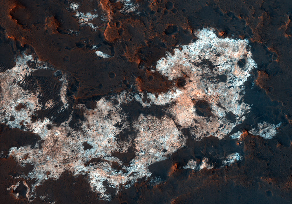
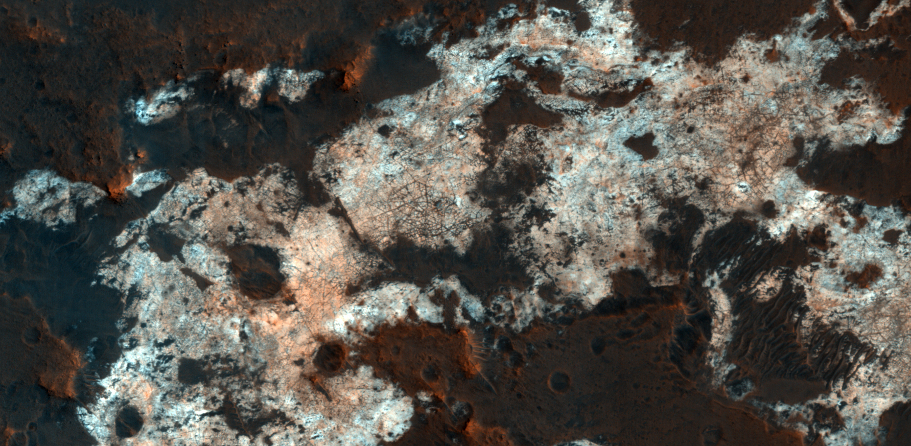
Mawrth Vallis is one of the regions on Mars that has attracted much attention because of the nature and diversity of the minerals identified by these spectrometers. It is a large, ancient outflow channel on the margin of the Southern highlands and Northern lowlands. Both the OMEGA and CRISM instruments have detected clay minerals here that must have been deposited in a water-rich environment, probably more than 4 billion years ago. For this reason, Mawrth Vallis is one of the two candidate landing sites for the future Mars Express Rover Mission planned by the European Space Agency.
This image was targeted on a location where the CRISM instrument detected a specific mineral called alunite, KAl 3 (SO 4 ) 2 (OH) 6 . Alunite is a hydrated aluminum potassium sulfate, a mineral that is notable because it must have been deposited in a wet acidic environment, rich in sulfuric acid. Our image shows that the deposit is bright and colorful , and extensively fractured. The width of the cutout is 1.2 kilometers.
Written by: Paul Geissler (4 September 2017)
More info and image formats at http://hirise.lpl.arizona.edu/ESP_051153_2025
Image: NASA/JPL/University of Arizona